2021 May - The Great Loop: Albemarle Sound & Dismal Swamp Canal to Portsmouth VA
- Lisa
- May 31, 2021
- 14 min read


Great Loop Overall Statistics to date:
Statute Miles: 1177.5
Average Miles/Day: 53.5
Total Hours Underway: 165.2
Average speed (mph): 7.6
States Transited: 5
Total Days: 53
Travel Days: 22
Locks: 7
Fuel Purchased: 241.4
Miles / Gallon: 3.2
Nights at Extra Days
Marinas: 9 27
Anchor: 10 1
City dock: 2 0
Free Wall: 1 0
Mooring: 0 0
----
Schedules don’t necessarily allow for the best planning for tides and current. Due to the time of day we wanted to leave and the distance we planned to cover, we had foul current most of the way up Adams Creek. This added about 45 minutes to our overall travel time as our average speed was reduced by nearly 2mph. The alternative would have us waiting until after the noon hour to leave Beaufort. We chose to make more travel distance at a reduced efficiency rather than wait.
On this first day, we crossed the first 1000 mile mark of the Great Loop.
The Neuse River was very calm this time. Calm winds for the previous few days were not strong enough to churn up any waves.
The town dock at Belhaven is run by the adjacent marina. They do an efficient job at management. The docks are fairly new and very stout. It is just steps from the restaurants downtown.
It was another long day up to Durant Island at the top of the Alligator River. The winds were much stronger than predicted as we exited the Alligator-Pungo Canal and were funneling south down the river as we were trying to make our way north. We were bashing into 2-3 foot short chop for most of the way up, through the bridge, in over to Durant Island which was protected to the Northeast from the wind. We planned to stay here, just south of the Albemarle sound opening until the weather was just right to go across without the notoriously uncomfortable chop. It turned out the early morning hours of the next day were perfect and we scooted across smooth water into the Pasquotank River.
The free dock at Mid-Atlantic Christian in Elizabeth City was quiet and comfortable. It was a short walk to the downtown restaurants.
We wanted to make the first opening of the South Mills lock at 8:30 AM which was more than 2.5 hours away at our cruising speed. We left right at dawn and started up the Pasquotank River. We were immediately met with thick fog. We motored slowly with the foghorn sounding for nearly 2 hours and barely made the lock. We considered that we were unlikely to see any oncoming vessels since the lock was closed until 8:30 this morning, so we only had to keep an eye out for anchored vessels and those just getting underway along with us.
We had no trouble at all in the Dismal Swamp Canal. We heard two small bumps against the hull from small floating branches, but no big thumps or any keel hits from submerged objects. The shallowest water we noticed for the entire canal was right around 5 ft. We stayed well behind any boats in front of us.
We arrived at the Deep Creek lock drawbridge at the appointed time of the lock opening on the other side of the bridge. It took 45 minutes to get the boats through the lock and then down to the bridge we were waiting to open. Only then was it our turn to pass under the open bridge and then on into the lock. We would have benefited from moving even slower and timing our arrival just a bit later.
The remainder of the passage to Portsmouth was uneventful and had neutral current. We arrived at Ocean Yacht Marina with plenty of daylight to spare.
----
Great Loop Travel Days (GLTD):
019: Belhaven NC from Beaufort NC
020: Alligator River (Durant Island Anchorage) NC from Belhaven NC
021: Elizabeth City NC from Alligator River (Durant Island Anchorage) NC
022: Portsmouth VA from Elizabeth City NC
Map of our Great Loop travel:
GLTD019 Belhaven NC (from Beaufort NC): We were going to try to make it a long day, so we set our alarm clocks, got up early and left Beaufort Docks before 6:00 AM. By first light, I was tidying the dock lines.

It was calm enough for me to prepare sausage and egg bake in the Instant Pot. Ray appreciated a warm breakfast underway!
As we entered Adams Creek, to crosse over to the Neuse River, we spotted the tiny beginnings of a sundog.

R.E. Mayo Seafood, in Hobucken NC, is a familiar sight for Ray and me, along the cut between the Bay River and Goose Creek. We have taken this cut may times while cruising between the Pamlico and Neuse Rivers.
This is an inexpensive stop along the ICW. The docks are old -- and there are no real services besides fuel, but the price is right! Also, the ability to buy fresh shrimp right off the boat is a nice extra. We did not need to stop this time.
The shrimp trawlers were in port on this Sunday afternoon – hopefully a day of rest for these hard working watermen.

As we entered the Pamlico River from Goose Creek, I could zoom in on our old house with my new camera with a 65x zoom capability. Wow! From this…

…to this. Our house is in the center (built up on 8-foot pilings). The camera is good, but there was not enough detail to see the flood line indicator we painted on the piling after Hurricane Irene in 2011.

The water was like glass on the Pamlico River. This has not always been the case for us out here. Ray captured this photo of the river vanishing into the sky.

We arrived in Belhaven NC early afternoon and docked at the Behaven Town Dock. This is a very nice and inexpensive marina -- steps from downtown. The dock layout made it appear as if we had our own waterfront deck!

We took a long walk for exercise and exploring. We haven’t been to Belhaven in about 6 years. The River Forest Manor has had a major restoration. It was once an Inn with restaurant; it is now an event venue – mainly for weddings.

The jasmine in the meditation garden at St. James Episcopal Church smelled heavenly.

After showering, we walked about a block to our favorite Belhaven restaurant – the Tavern at Jack’s Neck. During Covid, they opened a new outdoor dining option called the Breakwater. Ray had brick oven pizza and I had barbeque. Delicious! And the owner has created yet another awesome dining space!

The sun set peacefully behind a thick blanket of clouds.

GLTD020 Alligator River (Durant Island Anchorage) NC (from Belhaven NC): This was another early morning for us, and the sunrise over the glassy water was serene as we departed the marina.

Clouds began to clear to the north, as if to guide us to our next destination.

As we neared the Pungo-Alligator River Canal, the coffee-colored water color was apparent in our wake -- so different from the aqua waters of the Florida Keys.

📞 Future stay marina planning: I called Mid-Atlantic Christian University, in Elizabeth City NC. They confirmed they still offer free dockage and explained the space they have available.
📞 Future stay marina planning: I reserved a slip in Portsmouth VA, and Ray made several calls to find a dealer who would overnight (to the marina) the part we needed to repair the generator coolant leak.
By late morning, I started preparing lamb stew in the Instant Pot.

When I went back up to the salon a half-hour later, Ray told me the winds had kicked up and we were taking water over the bow. Thankfully, I had not noticed. 😊
⚓Anchored. We anchored near Durant Island (Alligator River) early afternoon -- in moderate 17 mph winds.
We spent a few hours catching up on computer work.
🟠 Life Afloat Tip: It is helpful to have a good internet service.
We use a cellular router from a third-party vendor/reseller that supplies a SIM card and a cellular business plan. The cellular plan is a true unlimited data plan with no throttling. We bought the hardware (router) as part of the sign-up. This provides a “local” WiFi network within our boat. All of our internet needs are provided by this cellular link and has worked well for the last three years.
This cellular service that we use for the WiFi router happens to be from the “other” major cellular network provider than each of our phone’s cell service, so it provides some redundancy (if we set the phone to a hotspot) in the case where one or the other is in a poor service area.
We had an early dinner – delicious lamb stew! And I had enough left over to freeze a couple of individual meals.

GLTD021 Elizabeth City NC (from Alligator River (Durant Island Anchorage) NC):
🔷 Boater Tip: Do regular engine (or engine room) inspections.
Make a list of the items to check and more importantly, use it regularly. A list will do no good by itself. The items you might include on a list can be found from suggestions on various internet boating forums, personal experiences, and common sense.
Below is SCOUT’s (current) list, posted on the wall of the engine room.
We have already avoided at least three incidents that would have turned out much worse by doing regular inspections prior-to engine start and while underway.

During Ray’s Pre-Start Engine Room inspection today, he found and tightened a loose coupler bolt on one of the engines.

As we hauled anchor, there were a few midges (also known as fuzzy bills) hanging around the cockpit – hiding from the wind. We were thankful they were not the swarms we had seen other times.
Shortly after sunrise, I noticed another “juvenile” sundog. This must be sundog season! 😊

Interesting Fact: Well, maybe “sundog season” is partially true. While a rainbow usually indicates the end of rain, a sundog “often means that rain, or snow, is on the way.” And since it rains a lot in the spring,….hmm…
“Both rainbows and sundogs are formed by moisture filtering the sunlight. Rainbows form when drops of rain act as prisms, breaking sunlight into a multitude of colors. Sundogs appear when sunlight hits clouds of ice crystals and the ice acts as prisms.”
Our friend on sv Ladyship shared his thoughts when I posted this on Facebook: “Parhelion...one of the things we see on our boats that others rarely get to experience.” So true.
I’m thankful. This is just one of the special sights we get to see.
🔷 Boater Tip: Crossing the Albemarle Sound and choosing between the Elizabeth City/Dismal Swamp route or the Virginia Cut route.
- The Dismal Swamp Canal route is slower (lock schedules appears to be based on average speed of 5 knots), it is narrower (25 feet in a few places), and shallow (as low as 5.5 feet). You also have to be careful of floating logs/branches and may encounter semi- or fully- submerged stumps or waterlogged tree trunks (deadheads). There is always good advice offered on the many boating and looper forums. The suggestions I committed to memory are to go slow and to leave plenty of distance between you and the boat ahead of you, so that any logs the lead boat crosses will not be catapulted out from under his hull into yours.
- Since Virginia Cut is a route that allows for faster travel, more fast boats take this route, and hence, more passing wakes are produced. Slower boats get passed more often on this route and must contend with some potentially large wakes.
We chose Dismal Swamp route, stopping overnight in Elizabeth City (where there is a brewery 😊).

-The pink-dashed line on this chart shows our travel from the Durant Island anchorage where we “staged” for our crossing of the Albemarle sound during calm weather.
-The solid pink line shows our heading (direction) toward the Pasquotank River leading to Elizabeth City.
-The black “hashmarked” line shows the heading of another vessel ahead of us toward the North River. Due to the angle of his heading, it appeared that he would be taking the Virginia Cut (to the upper right).
This chart also shows the relatively shallow depth of the Albemarle Sound. You may have heard “horror stories” from boaters about their Albemarle Sound crossing.
If strong winds blow across a shallow body of water long enough, the water can stack up, creating waves that are close together with short, steep faces.This can make for an uncomfortable voyage across the sound.
🔷 Boater Tip: How did our chart know the “other vessel’s” existence nearby and its heading?
Since we have both an Automatic Identification System (AIS) transmitter and receiver, our chart shows other vessels who are transmitting AIS data. Our charting software will also alert us if a collision is anticipated (based on speed and heading of our vessel and other vessels in the area).
🔷 Boater Tip: How your land-based support team can use AIS to locate you.
MarineTraffic.com: If your family (friends) know your vessel identifier, they can search the last-known position of your vessel on MarineTraffic.com.
Below is a sample screen. When you click a boat shown in MarineTraffic.com, you can see more information about the boat.
NOTE: When a vessel is outside range of the AIS base stations, the vessel may show “Vessel is Out-of-Range”.
NOTE: This site is not a marine alerting or navigation tool – do not use this for real-time AIS data or your on-the-water vessel information. It is not a substitute for AIS equipment. The system uses sparsely-populated land-based towers and has significant delays through web servers and various computer systems.

In preparation for our next leg, we began researching procedures for locking through the Dismal Swamp Canal.
We had a short travel day today, arriving to Elizabeth City by late morning. Our destination was just beyond this draw bridge (to the right). Downtown Elizabeth City is on the left.

We stayed at the free docks at Mid-Atlantic Christian University. It was quite peaceful. (There were no classes in session when we were there.)
This photo of SCOUT was posted to one of the Facebook groups. (I’m sorry I cannot remember which group, or who took it. The post has since been deleted.)

Ray enjoyed photographing the Canada geese, practicing with our new zoom capabilities.

We walked downtown for exercise and ended up eating lunch at a nice outside location at Hoppin’ Johnz. The Hoppin’ John was delicious!

On the walk back, Ray got a little too close (for my comfort) for a photo of this beehive. Look how big!
If these are honey bees, I know from experience not to swat (and accidentally kill) one. Thankfully, during that learning experience, Daddy was nearby to spray me down with the water hose.
“When a honey bee stings, its stinger, the venom sac and other parts of the honey bee’s body are pulled out and left behind, killing the bee. Although the bee dies, its sting takes effect quickly, and, if the stinger is not removed quickly, the symptoms gradually increase as the venom sac continues to pump venom into the wound. Since the stinger is barbed, it often becomes lodged in the tissue of the animal. When a honey bee stings, it releases an alarm pheromone to alert the other workers in the colony. The result is other bees are recruited to the area to defend the colony as well.”


For dinner, we walked back downtown. But first, we stopped in at Ghost Harbor Brewing.

We ate at Hoppin’ Johnz again, because there were more menu items we wanted to try! Everything was too good. It was cozy at the bar!

GLTD022 Portsmouth VA (from Elizabeth City NC): Not wanting to miss the first opening time of the first lock at 8:30AM, we set alarm clocks for departure before 6:00 AM, as it was going to be 2 or more hours to get there from Elizabeth City.

It was a cold and misty morning.

As we entered the narrow twisting sections of the Pasquotank River, the fog rolled in, …
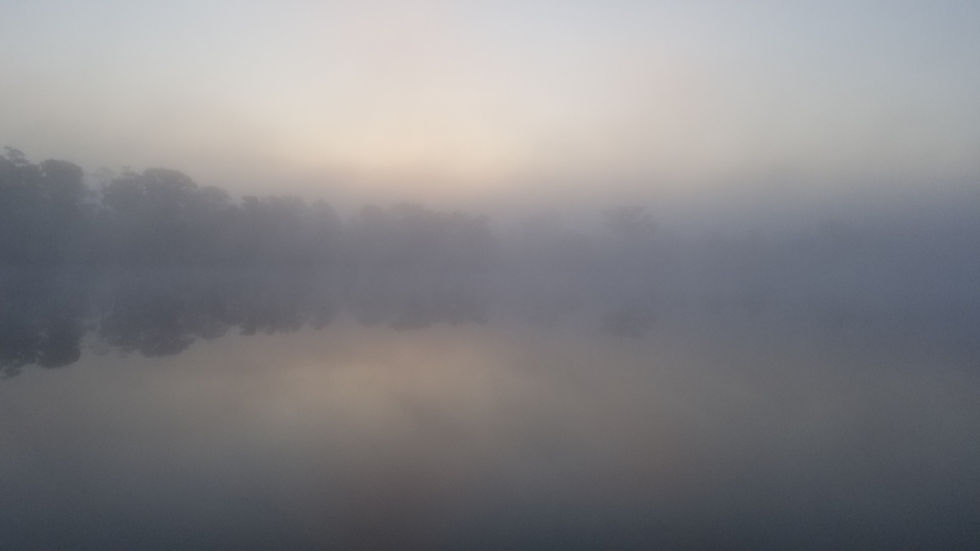
…forming a pretty backdrop for the landscape, but

…some anxious times navigating the river. The fog was really thick for about 90 minutes.

We travelled slowly with the fog horn, which periodically and automatically sounded our presence at 2 minute intervals. We could be fairly certain that we would not encounter opposing traffic since the lock at the mouth of the river was, and had been, closed until our targeted 8:30 time. There were, however, other boats anchored along the river waiting to proceed up river for that same opening opportunity.

The radar at the helm was helpful to see navigational markers and other boats in the river path. I didn’t think to photograph our helm, but I found a photo from March.

🔷 Boater Tip: Radar.
On the radar screen (above), you can clearly see the tree-lined edges of the channel we were in back then, as well as a few tall things further back beyond the edge.
Radar systems let you “see” through darkness, fog, and storms. “…radar proponents rightfully argue that their favorite device doesn’t rely on satellites, other vessels broadcasting a radio frequency signal or on-shore position enhancing beacons. … Radar’s versatility includes spotting and tracking thunderstorms at night, locating unlighted aids to navigation and picking out other vessels transiting in overcast conditions.”
As the fog began to lift, I saw yet another sundog. Do you see it?

The fog finally lifted a little, allowing us to see better -- including this open railroad bridge, but it hung around above us for miles.

We passed a solo sailor, sv LIBERTE, who we thought may not make the early lock schedule. (Thankfully he made it in time.) NOTE: You can see SCOUT’s wake in the photo. Before SCOUT overtook him, we had noticed his wake in front of us for several miles.

Just 20 minutes later – as we arrived at the first lock, the fog lifted, and the sun began shining. It was like it was time for the “show” we had heard so much about! 😊
Interesting Fact: In the lock, Ray noticed a sign indicating that it was the same distance from this location at South Mills Lock to both New York NY to the north and Savannah GA to the south.

Showtime!

Some of the curves in the canal were like a house of mirrors ----- How do we get out? 😊


🔷 Boater Tip: The Dismal Swamp.
“The Dismal Swamp Canal is the oldest operating artificial waterway in the United States.”

There are 2 locks:
- South Mills Lock (south) and
- Deep Creek Lock (north).
A video on the Corps of Engineers website shows use of the vessels’ own lines to lock through, unlike the Okeechobee Waterway, where we secured our vessel using lines already attached to the lock.
There is a draw bridge near each of these locks that is opened in conjunction with the locks. The lock operator, after allowing everyone out of the lock, announces over the radio, “Hold on and I’ll go up and open the bridge”, then gets in his car and drivew up the road to the bridge to open it for everyone!
On the map, notice the bridge is north of the lock at the south end, but south of the lock at the north end.
Since the schedules are for the locks, and the tenders will open the draw bridges just once, note that northbound traffic will likely have to wait for southbound vessels to lock through Deep Creek Lock (at scheduled lock time) and come through the bridge first.On the other “end”, northbound traffic will likely lock through South Mills Lock before southbound traffic.
For a better view of SCOUT in the canal, take a couple of minutes to watch some scenes from the drone.
We arrived at the Deep Creek draw bridge 45 minutes before the bridge opened (since the bridge doesn’t open until the southbound traffic has locked through). This was a narrow area in which we had to “hold station” for 45 minutes. 😕 Luckily the current was very light, and the winds were calm. (A boat was already tied up at the small free dock.)

The lock tender was very friendly. While all of the boats were readying lines inside the lock, he pointed out to us the nearby bald eagle that he had been watching. Ray was close to the helm door, so he was able to get the camera and get some photos.

Not long after transiting the 2nd lock, we entered the busy Portsmouth VA area, …

…where the Elizabeth River seems to be surrounded by Naval shipyards.

After a long 10.5-hour day of travel, we docked at Ocean Yacht Marina for a brief stay. This map shows the Downtown Tunnel (264) going right under the marina.

After checking in and freshening up, we walked 2 blocks for dinner at Legend Brewing. While waiting for dinner to arrive, we finally had a minute to review sights in the area and found out the Portsmouth Naval Shipyard Museum, just across the street, was still closed due to Covid. 😕

The next day we caught up on some chores. I had to bake gluten-free donuts since I was completely out -- and I must have them with my morning coffee. (I knew we were getting close to our destination because….Captain Ron reference.)
📞 Future stay marina planning: I also reserved a slip at our next destination, Yorktown VA.
For an early dinner, we walked a few blocks to Bier Garden (German), recommended by our Great Harbour friend from mv Carolyn Ann. My “Dad’s Special” -- tenderized grilled pork loin – was very good.
The “POO” sticker (on the wall to the right” caught my attention. The sticker was for Peaks of Otter, a remote hotel on the Blue Ridge Parkway, where we had spent many fall weekends with friends a long time ago. It’s really a small world!

On the way to dinner, we stopped to photograph a few churches.
St. Paul’s Catholic Church was stunning. “St. Paul’s Catholic Church was first built in 1813 by French and Irish immigrants. This is actually the congregations’ fifth building (once the membership expanded and twice the previous churches were burned down).”
Alongside the main church sign was a monument “erected, by the citizens of Portsmouth, in memory of Rev. Francis Devlin … who sacrificed his life in the cause of charity during the plague of 1855.”


Monumental Methodist Church “was built in 1831, but it actually dates back to 1772 when Rev. Robert Williams, a Methodist minister and missionary preached here making it the oldest continuing Methodist congregation in the South and the third oldest in the nation.”
What’s next? Watch for our next post, where we will cross the border into our 5th state.


Comments